JF Ptak Science Books Post 2582
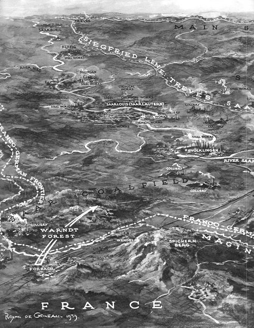
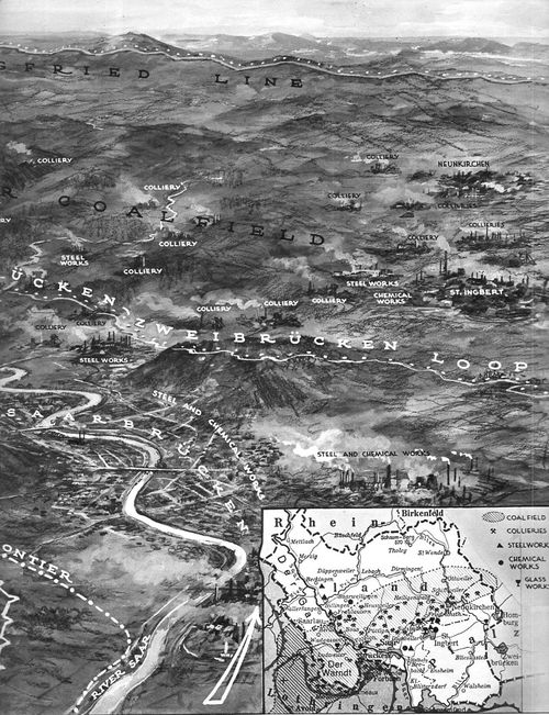
This orderly and semi-pastoral bird's-eye view of the earliest part of the war in the west of WWII appeared in The Illustrated London News on September 30, 1939, three weeks or so after the Nazi attack on Poland. The foreground shows about 40 km of the front from the river Nied to the Saar and south to Saarburgken, with the Siegfried Line in the distance. The map shows the region into which 40 French divisions advanced from September 7-16, meeting little resistance from the outnumbered German troops who by and large fell back to more defensible positions.
Not much happened.
This period of the war has often been referred to as the "Phony War" due to the lack of action, though it wouldn't seem so "phony" if you were killed in the process, as thousands were. Winston Churchill referred to it more as the "Twilight War", which is far more appropriate--and this no doubt more meaningful to Churchill int he light of the HMS aircraft carrier "Courageous" being sent to the bottom by Nazi torpedoes with the loss of more than 500 sailors...there was certainly not a bloody thing "phony" in that.
The French referred to this period as the "Drole de Guerre", which they really shouldn't've done--their Saar offensive of mid-September being stunted and odd, came to a halt, and the troops called back to the doomed Maginot in October.
The Twilight War continued until late April, and then in May, it was certainly all over, as the Nazis attacked Belgium, Luxembourg, and the Netherlands. And then of course came France. In just about the same amount of time that the Saar Offensive occupied, the Germany advanced and forced France to surrender, the curtain coming down on June 22. Calm before the storm, and all that--the rest of the war was more storm before the storm, until there was storm no more.
And the text accompanying the maps:


Comments