JF Ptak Science Books Quick Post
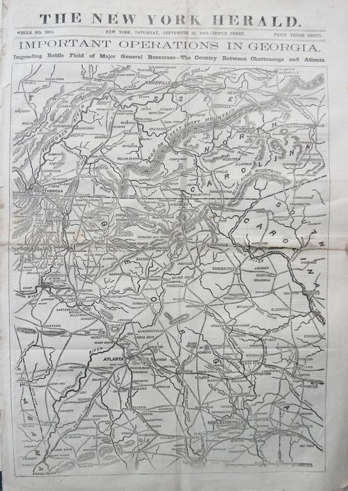
This fine map popped out at the warehouse today--the New York Herald, September 10, 1863, with a fantastic full-page/front-page map of the theater of war in Georgia (and southern Tennessee and south-western North Carolina), back when newspapers were newspapers. But the map centers on Georgia, and comes just a week before the second bloodiest battle of the war at Chickamauga. (The town appears right underneath the label for "Chattanooga".)
My own Hendersonville appears at the extreme east portion of the map in North Carolina, just north of the South Carolina line. Most of the mountains seem to not make a very formidable entrance on this map (though Cold Mountain is seen just to the north-west of Hendersonville), and I think it is somewhat deceiving. I've driven the mountains a lot in Western North Carolina and often thought of slogging around the region in the foothills, avoiding all of the mountains that I was driving through which really didn't show up on this map. There's a reason that there wasn't that much in the way of conflict in this region of WNC, northern SC, and eastern Tennessee--of course there wasn't much worth winning, but marching through the mountains would have been a major piece of bad country to go through.
In any event, this was a good map for northern and central Georgia, introducing northern readers to an advancing front of the war.


Comments