JF Ptak Science Books Post 2275
One of my favorite atlases of all-time is Adolf Stieler's Hand-Atlas (Hand-Atlas über alle Theile der Erde und über das Weltgebäude, published in Gotha, Germany, by Justus Perthes) and edited by August Petermann. I love this series (there were eight editions and a number of intervening printings to 1891) because the maps seemed so impossibly detailed for their scale. They have so much detail and such great relief that in some very odd way they almost do not look like maps. The sheets have massive amounts of info, particularly so with areas in which you do not expect it.
This post came to be because I bumped into an old Stieler-friend--the six-sheet map of the United States. I have four different flavors of the map, but the one I like the most is from 1891. The sheets are all produced to be pieced together contiguously, so that they form a map 28"x52"--and there is so much detail the work looks a little like carto-graffiti, except of course that it isn't, and that all of the extremely small and fine engraving piles one next to the other make for a very accurate and full map of the country.
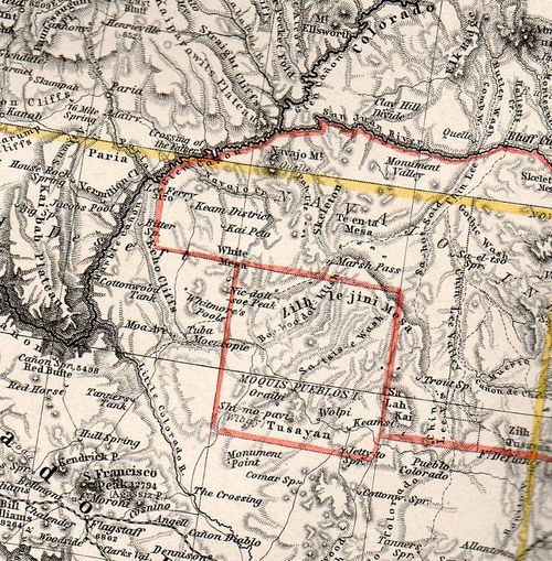
Take, for example, the Four Corners region, mainly for north-east Arizona:

This is about 50% larger than the original, about a 2"x3" section of one 15"x18" section of the six-section map, and it is just packed with detail.
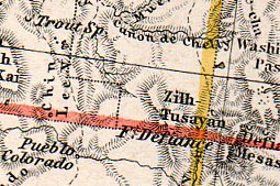
And here, a smaller detail, of about a one square inch section of map, concentrating on the Canyon de Chelly. Now I know this area a little, and about the history of its cartography (somewhat), and I can safely say that this is just tremendously detailed given the scope of the map. The remarkable thing about the Stieler atlas is that all of the maps are like this. Extraordinary--not particularly beautiful in the traditional over-the-fireplace sense f beautiful, but fantastic as, well, maps (of particular and perhaps peculiar scientific loveliness).


Comments