JF Ptak Science Books
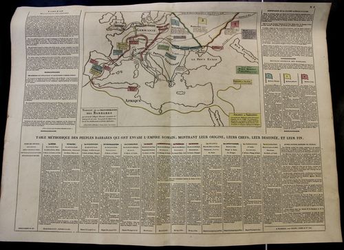
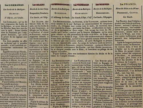
It is interesting to look at the Roman Empire from "The Other Side", seeing the world (extending from Ireland to the Caspian) of the surrounding and numerous Barbarians. This map was printed in 1808 and identifies the peoples at all points of the compass outside of the Empire: Huns, Goths, Visigoths, Ostrogoths, Lombards, Vandals, Swedes, French, Anglo-Saxons, Sarrasins, Germans, Avars, Bulgarians, Danish, Hungarians, and others, all outlined in 14 columns beneath the central map. This is a finely-designed, accurate, and attractive way of displaying a lot of data in a relatively small (27x21") space.
[Note: the image below is very expandable and readable when enlarged.]
And a detail:
The map appeared in A. Le Sage (Comte de La-Casas) Atlas historique chronologique et géographique ou Tableau général de l histoire universelle présentant un moyen sûr et facile de classer avec fruit tout ce qui s est passé depuis la création jusqu à Jésus Christ espace de 4004 ans.... The sheet measures 27x21" or 68x53cm. The coloring (except for the odd darkish green) is fairly subtle but evident and useful in distinguishing the blocks of data at an easy glance. Printed on heavy paper. Very good condition. $125


Comments